
Map ZES-zone
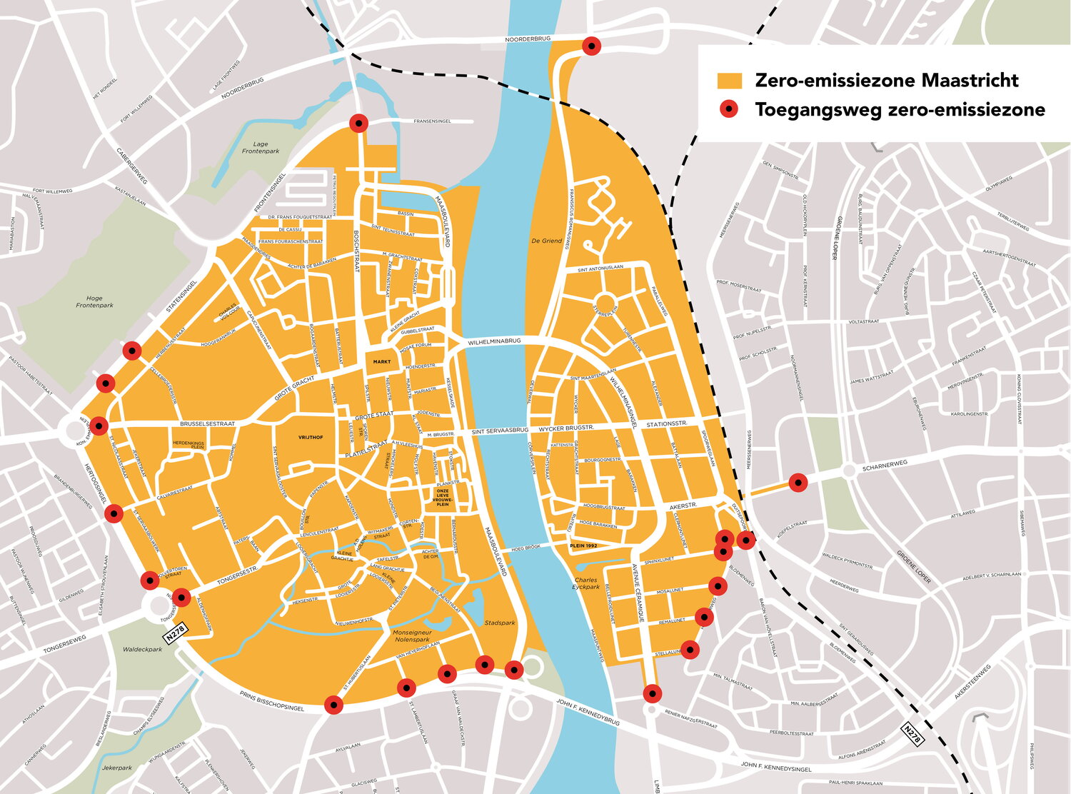
Map of the zero-emission zone in Maastricht. The boundaries of the zero-emission zone are defined by the area enclosed by:
- On the west side of the Meuse: Fransensingel, Frontensingel, Statensingel, Hertogsingel, Prins Bisschopssingel, J.F. Kennedysingel.
- On the east side of the Meuse: Noorderbrug, François de Veijestraat, railway line (including Scharnertunnel), Duitsepoort, Sphinxlunet, Heugemerweg, Jonkheer Ruysstraat, Renier Nafzgerstraat, and the roundabout Avenue Ceramique/Limburglaan.
View the map in a larger format, or save it to your computer or laptop.
